The Regional Centre for Mapping of Resources for Development (RCMRD) was established in Nairobi ? Kenya in 1975 under the auspices of the United Nations Economic Commission for Africa (UNECA) and the then Organization of African Unity (OAU), today African Union (AU).
RCMRD is an inter-governmental organization and currently has 20 Contracting Member States in the Eastern and Southern Africa Regions; Botswana, Burundi, Comoros, Eswatini, Ethiopia, Kenya, Lesotho, Malawi, Mauritius, Namibia, Rwanda, Seychelles, Somali, South Africa, South Sudan, Sudan, Tanzania, Uganda, Zambia and Zimbabwe.
Our Vision: To be a Premier Centre of Excellence in the provision of geo-information and allied technologies for sustainable development in the member States and other stakeholders.
Our Mission: To strengthen the member States and our stakeholders? capacity through Generation, Application and Dissemination of Geo-information and Allied Technologies for sustainable development.
Our Core Values
- TEAM WORK - Driven by team spirit and a sense of belonging through the pursuit of collaborations and synergy.
- CUSTOMER FOCUS - Committed to the effective and efficient delivery of quality and appropriate services/products to all our stakeholders.
- STAKEHOLDER ENGAGEMENT - Proactively and continuously engage our stakeholders and users for relevance and value proposition.
- INNOVATION AND CREATIVITY - Continuously improve our operations and add value to our stakeholders by embracing and pursuing innovative and creative solutions.
- ACCOUNTABILITY & TRANSPARENCY - Uphold professionalism, integrity, honesty, and ethical practices in all our programs and operations.
- EQUITY & INCLUSIVENESS - Embracing value for people by treating our staff and our stakeholders with respect and dignity while appreciating their diversity.
Our Approach
RCMRD functional programmes have moved away from service technology framework (e.g. Remote Sensing, Geodesy, Cartography etc.) to problem solving applications in natural resource and environmental management. RCMRD is now providing service on demand driven basis.
RCMRD is now moving into the future with confidence and endeavors to live up to its values of upholding the highest standards of services to its customers and continuously improving the quality of services and products.
Regional Center for Mapping of Resources for Development - History
The Regional Centre for Mapping of Resources for Development (RCMRD), previously known as Regional Centre for Services in Surveying, Mapping and Remote Sensing (RCSSMRS) was established in Nairobi, Kenya in 1975 under the auspices of the United Nations Economic Commission for Africa (UNECA) and the then Organization of African Unity (OAU). Its founder members are Kenya, Uganda, Somalia, Tanzania and Malawi and the Government of the Republic of Kenya hosts it. It is a non-profit intergovernmental organization and currently has 20 Contracting Member States in the Eastern and Southern Africa Regions; Botswana, Burundi, Comoros, Ethiopia, Kenya, Lesotho, Malawi, Mauritius, Namibia, Rwanda, Seychelles, Somali, South Africa, South Sudan, Sudan, Swaziland, Tanzania, Uganda, Zambia and Zimbabwe.
The original objectives of the Centre were:
To provide services in the fields of surveying and mapping including aerial photography, photogrammetry, photo-interpretation, first order geodesy, remote sensing, calibration and maintenance of surveying and mapping equipment;
To provide training for nationals of contracting parties in surveying, mapping and remote sensing, and; To provide advisory services upon request on problems relating to surveying and mapping to the governments of member States.
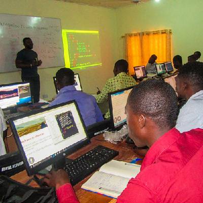
Since its establishment, the Center has been very instrumental in capacity building in resource survey, mapping, remote sensing, GIS and natural resources assessment and management in Africa. It was also instrumental in helping different countries establish their National Mapping Agencies. To date the Centre in any given year trains more than 3000 technical officers from its member States and other African countries in the fields of surveying and mapping, remote sensing, GIS and natural resources assessment and Management. The Centre has also implemented numerous projects on behalf of its member States and development partners.
Related articles
-
The Bird and the Mirror: A Reflection on Identity, Perception, and Illusion
07-Feb-2025 -

How AI is Transforming the Work Environment and Creating New Job Opportunities for High School Students
11-Jan-2025 -

Top 20 Career options for Kenyans in 2025
11-Jan-2025 -

Engineering Diploma Programs in Kenya: A Comprehensive Overview
11-Jan-2025 -

Bachelor of Science Nursing Degree Program in Kenya: An Overview, Objectives, Entry Requirements, and Institutions Offering the Program
11-Jan-2025 -

Diploma in Applied Biology
18-Dec-2024
Programs offered at Regional Center for Mapping of Resources for Development
Certificate
Cartography
Certificate
Information Technology
Certificate
Land Surveying (Craft)
Certificate
Photogrammetry
Diploma
Cartography
Diploma
Land Surveying
Diploma
Map Reproduction (Printing)
Certificate